Chicken Corners
Kane Creek Road
Length
43 Miles
Time
5-6 Hours
Difficulty
Moderate
Rating
Season
All Year
Fees
None
Route Type
Out and Back
About This Trail
A stunning shelf road along the Colorado River with 400-foot drops, ending across the canyon from Dead Horse Point.
Local Tip
The attractions start long before the trail does: watch for the petroglyph panels in the first few miles of Kane Creek Road and the short Hunter Canyon walk on the way out. Time your return for late afternoon, when the canyon walls along the river light up, and you're driving straight into the best of it.
Trail Description
Chicken Corners is Moab's classic scenic shelf-road adventure. The route follows Kane Creek Road out of downtown, past petroglyph panels and Hunter Canyon, then climbs onto a ledge high above the Colorado River as it snakes toward Dead Horse Point.
The trail gets its name from the final narrow stretch, where the road pinches down along a cliff edge and nervous passengers ("chickens") historically got out and walked. The driving is mostly easy, graded dirt and embedded rock, with one moderate rocky climb near Hurrah Pass.
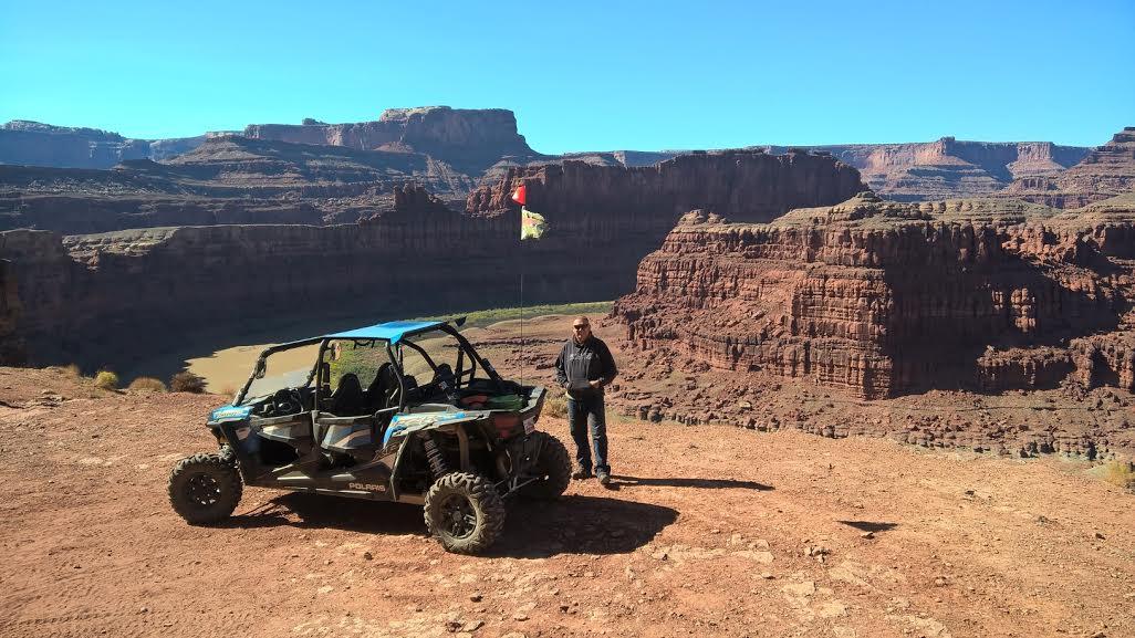
The payoff is the viewpoint at road's end: the Colorado River sweeping through a gooseneck bend 400 feet below, with Dead Horse Point towering directly across the canyon.
Trailhead & Staging Area
From downtown Moab, take Kane Creek Boulevard west and follow Kane Creek Road along the Colorado River. The pavement ends after about 4.5 miles; continue on the dirt road through the canyon toward Hurrah Pass. No fees or permits required.
Drive Route
About 26 miles round trip from the end of the pavement; allow 4-5 hours. Stock high-clearance 4WD handles it fine in dry conditions. The rocky climb over Hurrah Pass is the crux. Not recommended after heavy rain, when Kane Creek crossings can run deep. Watch for mountain bikers on the lower canyon section.
Interactive Map
Load the track into Gaia, onX, or your GPS unit for offline navigation. There is no cell service on most of this trail. Route is for reference only; conditions change, so check with the BLM or NPS before you go.
Track data © OpenStreetMap contributors
Trail Photos
Ready for More Adventures?
Explore more scenic drives and outdoor activities in the Moab area.