.jpeg&w=3840&q=75)
Fisher Towers Trail
Colorado River Road
Difficulty
ModerateLength
4.2 Miles
Time
2-4 Hours
Trail Type
Out and Back
Pets
Yes
Required Gear
Standard Day Hike Gear
Rating
Season
All Year
Fees
None
About This Trail
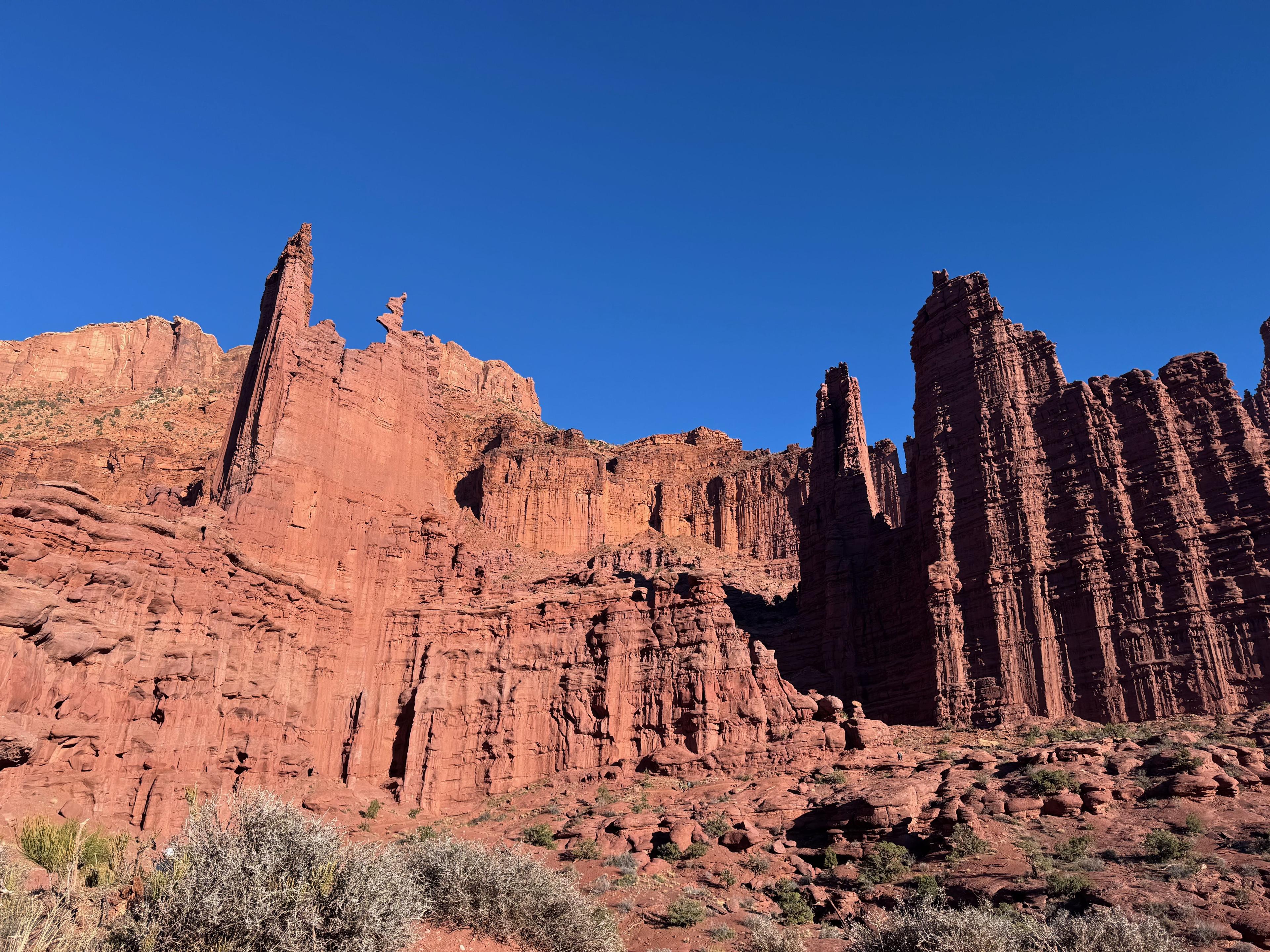
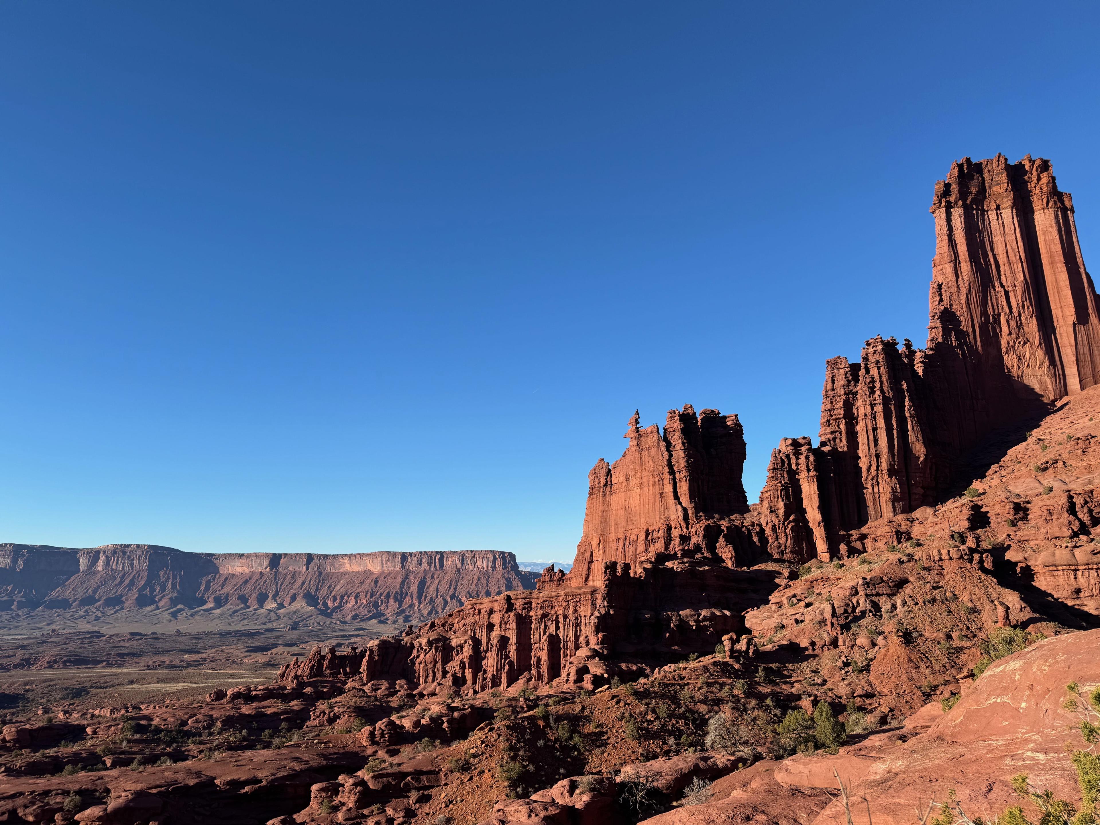
The Fisher Towers Trail winds through one of Moab's most surreal landscapes, featuring towering sandstone spires and unique formations like Ancient Art and The Titan. This moderate 4.2-mile round-trip hike offers incredible desert views, but bring plenty of water as there's minimal shade.
Trail Description
The Fisher Towers Trail offers hikers an opportunity to explore one of the most distinctive geological landscapes in the Moab area. Located approximately 21 miles northeast of Moab along the Colorado River, this trail winds through a maze of soaring sandstone towers, dramatic pinnacles, and sculpted rock formations that create an almost otherworldly atmosphere.
The geological composition of these formations is particularly fascinating. The towers consist of dark red Cutler sandstone at their base, topped by harder Moenkopi sandstone caps, with dramatic mud curtains draping down their sides. This unique layering, combined with millions of years of erosion, has created the bizarre and beautiful landscape that makes Fisher Towers so memorable.
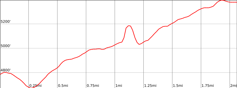
Due to the complete lack of shade along the trail and the intense desert sun, it's essential to plan your hike for early morning or evening hours during the summer months. Bring plenty of water, wear sun protection including a hat and sunscreen, and be prepared for the moderate elevation gain of 650 feet. The trail is well-marked with cairns and rock stacks, making navigation straightforward, and dogs are welcome on leash.
Trailhead Info
The Fisher Towers trailhead is located approximately 21 miles northeast of Moab. From Moab, drive north on US 191 and just before reaching the Colorado River Bridge, turn right (east) onto UT 128, also known as River Road. Follow this scenic paved highway for 21 miles until you see a turnoff marked for Fisher Towers. Turn right (south) onto the dirt road and follow it southeast for another 2 miles to reach the parking area and campground.
The trailhead features a parking lot, trail register, informational sign, and a pit toilet. There's also a small BLM campground nearby if you're interested in camping in the area. The trail begins at the north end of the parking area, where you'll find clear signage marking the start of the route.
Trail Info
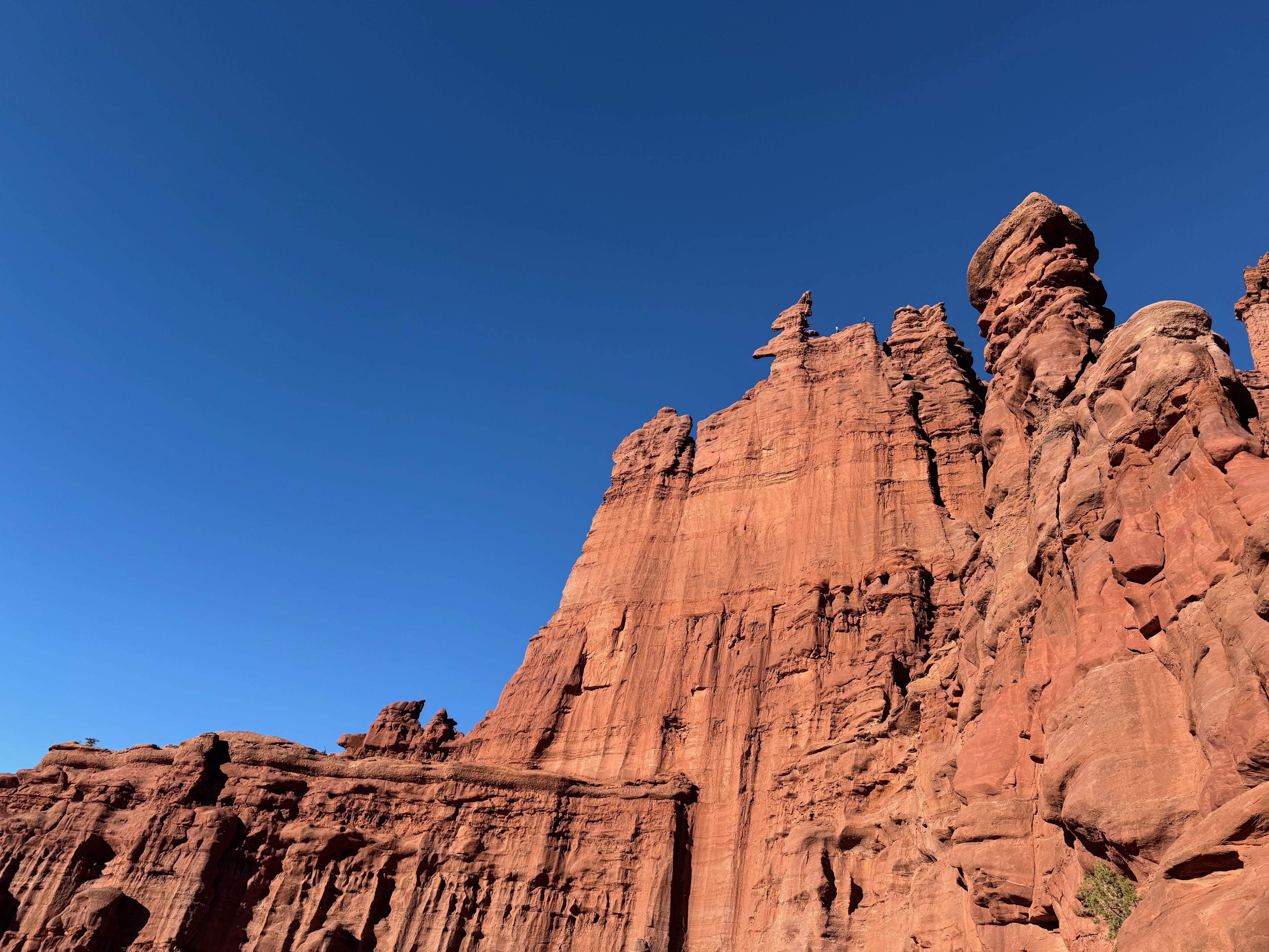
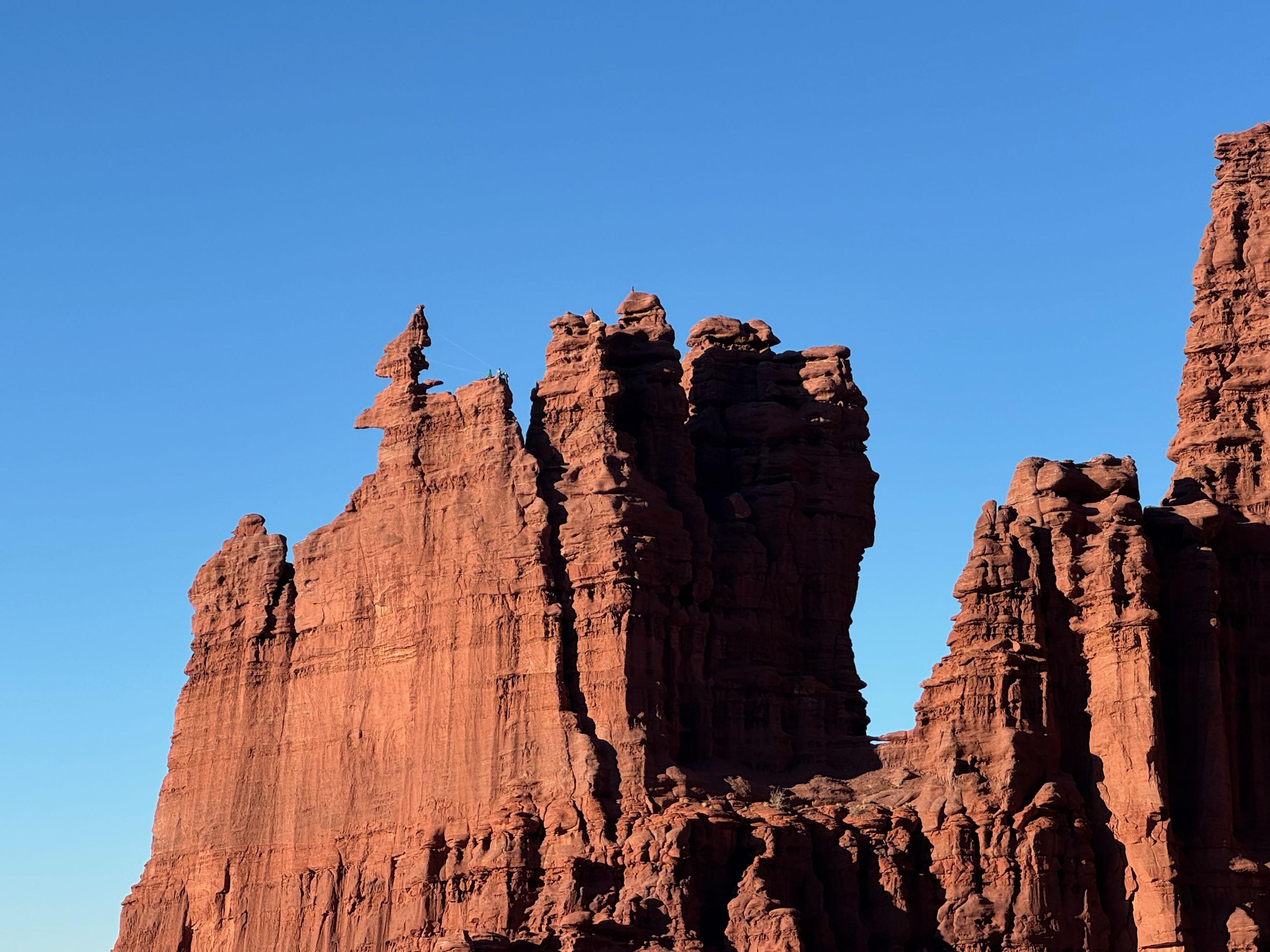
The trail begins by descending a short hill and crossing slickrock before dropping into a canyon. At the bottom, the path climbs out of a side canyon and winds around the west side of Ancient Art, a striking formation known for its corkscrew-shaped summit. After about 0.75 miles, you'll reach a viewpoint south of Ancient Art where many day hikers choose to turn around for a shorter 1.5-mile round trip.
Continuing onward, the trail traverses rocky slopes beneath the imposing north face of Cottontail Tower, which rises an impressive 800 feet above the desert floor. The trail reaches the base of Cottontail's sharp west ridge after approximately one mile, where the solid bedrock provides an excellent resting spot with commanding views of the surrounding formations.
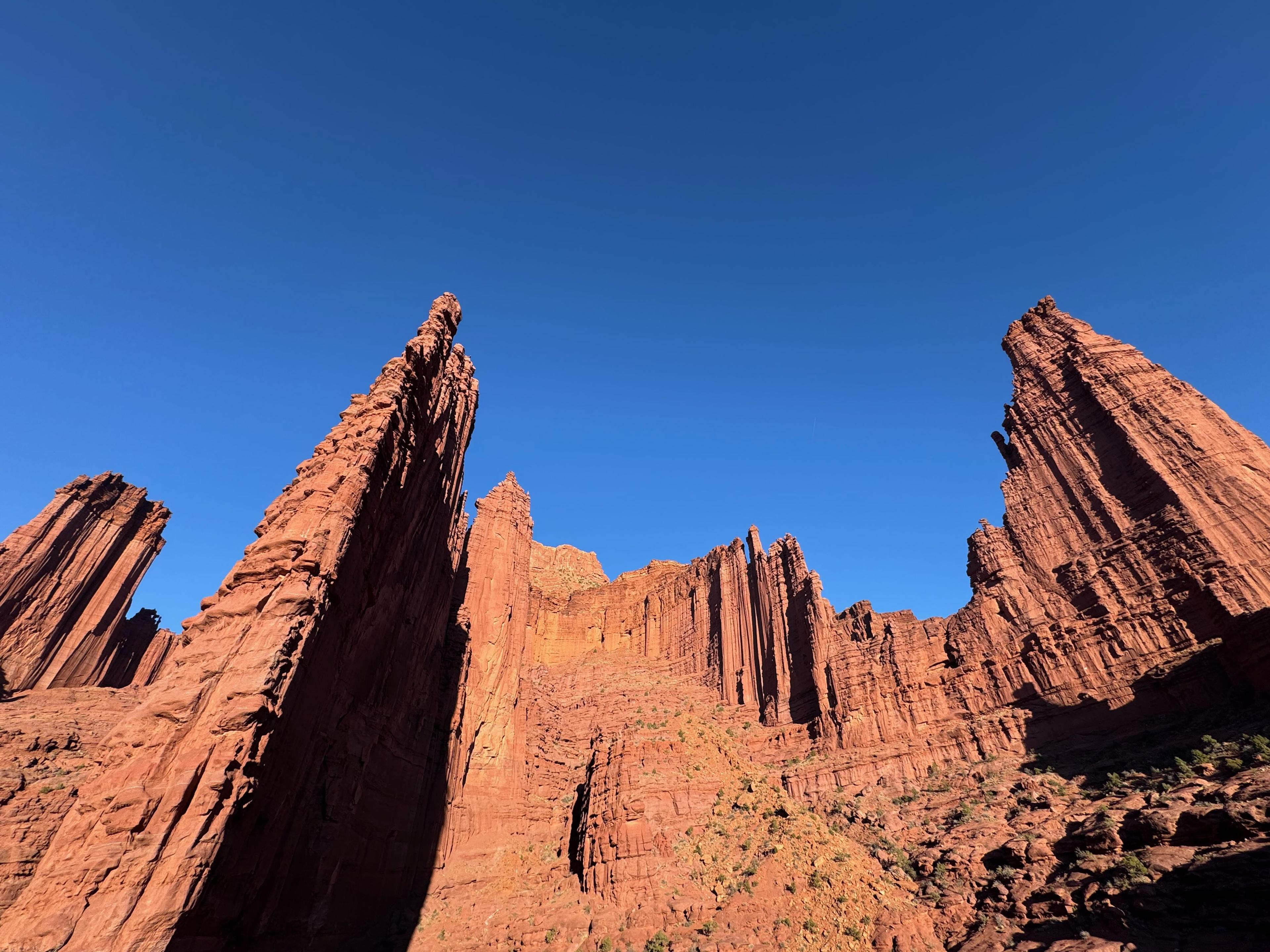
Beyond Cottontail Tower, the route becomes more adventurous as it dips into canyons and requires navigating a six-step metal ladder. The trail then contours across rocky slopes before slowly climbing around The Titan, the tallest of the Fisher Towers and a legendary destination for experienced rock climbers. Near the base of The Titan at approximately 2 miles, hikers pass through a narrow stone notch and traverse an exposed ledge that requires careful footing, especially when wet or covered in snow.
The final section of the trail climbs onto a high ridge at 2.2 miles, offering spectacular panoramic views. To the north, you can see the distant Colorado River Canyon, while to the west, a long ridge displays additional impressive pinnacles including Castleton Tower and The Priest. Many hikers choose this ridge as their turnaround point, though the trail continues another 0.4 miles to a rounded rocky knoll with even more expansive views of the Fisher Towers and the deep canyons that plunge south toward Onion Creek. The return journey is all downhill, making for a faster and easier trip back to the trailhead.
Elevation Profile and Map
Elevation Charts
Interactive Map
Trail Photos
Ready for More Adventures?
Explore more hiking trails and outdoor activities in the Moab area.